This is the last in a short series of posts on my research into John Balshaw’s Jig. It’s a short ‘musical comedy’ written by a man in Brindle, Lancashire, in the mid-seventeenth century. I found the manuscript in the British Library a couple of years ago, and transcribed it, and I’ve already written a blog post about that. It wasn’t taken up by the journal I sent it to, but in some respects I’m quite glad, as it’s given me the chance to expand the project a little further. I’m now hoping that it’s going to be published next year by the Regional Heritage Centre at Lancaster University.
For the moment, I think this will be the last in this series of posts, as I’m getting to the point where I don’t have a lot more to say – I’ve nearly got my manuscript to the point where I need to pass it on to my fiend and other people to read and see how they find it. In fact I wasn’t going to write any more after post 5, then I tried the music and had to write about that. Then I definitely wasn’t going to write any more posts, because really I had nothing else to say. And then…
I had one of those moments that make all the hours of messing about and getting nowhere and going round in circles worthwhile.
One of the moments when it almost seems possible to touch the past.
I’d got hold of a copy of William Senior’s map of Brindle from Chatsworth House. I only emailed them on the off-chance. Most of the places I’ve contacted in an attempt to track down documents over the last few months have politely said ‘yes, we’ve got x, y or z but we’re not at work so we can’t access it’. But not, this week, Chatsworth Archives.
Brindle’s lord of the manor was the earl of Devonshire, and in 1611 or so he commissioned William Senior to conduct a survey of his estates and create maps to go with them. I managed to get hold of a copy of Fowkes and Potter’s edition of Senior’s survey, and there were two Balshaws… and a copy of the Brindle map – but it was too small to read who and what was where.
I contacted Nottingham University Special Collections first, because they hold black and white ‘copies’ (hard to know what that means) and I thought that if they were images, they might be able to access them from home. Sadly not, apparently.
But it did turn out to be a blessing in disguise, because on Monday I tried Chatsworth. By the end of the day they had confirmed that yes, they already had a digital image and they could send it to me for just £3. Yes, just £3. Even I can afford that. I paid up, and the next day it arrived in my inbox.
When I opened it, it wasn’t just a black and white image, but a beautiful full colour map marked with little trees, houses and windmills. The roads are in brown, and each person’s landholdings are painted in different colours. It took me a little while to find the Balshaw land, and I began to get a little bit excited…
Could it possibly be…?
I’d better check.
So I compared Senior’s map with the large scale Ordnance Survey map from the mid nineteenth century on the National Library for Scotland website. The advantage of this map is not just the detail (25 inches to a mile is just fabulous!!!) but the fact that, being an intermediary one between then and now, it includes some bits of Brindle that have since disappeared (some, for example, are now under the M61 and more recently, the M65), so it’s better for working out exactly what is where. Senior, after all, didn’t manage to be completely exact in his rendering of the village – it’s brilliant, but it’s not exactly accurate. So I traced the road down the hill from the church past the turn to Pippin Street to another turn and a path marked on the other side of the road.
It really might be….
Let’s check with Google maps.
I traced the road down the hill from the church past the turn for Pippin Street to another turn, but the path marked on the other side of the road isn’t there… So I flipped to the satellite view, and there is a line of trees where the path should have been. I dropped my little yellow person on the road, and to be honest even on Google Streetview, it’s hard to tell whether there is actually still a path there as well as the gateway that allows access to the field. I turned round and yes…
Bingo:
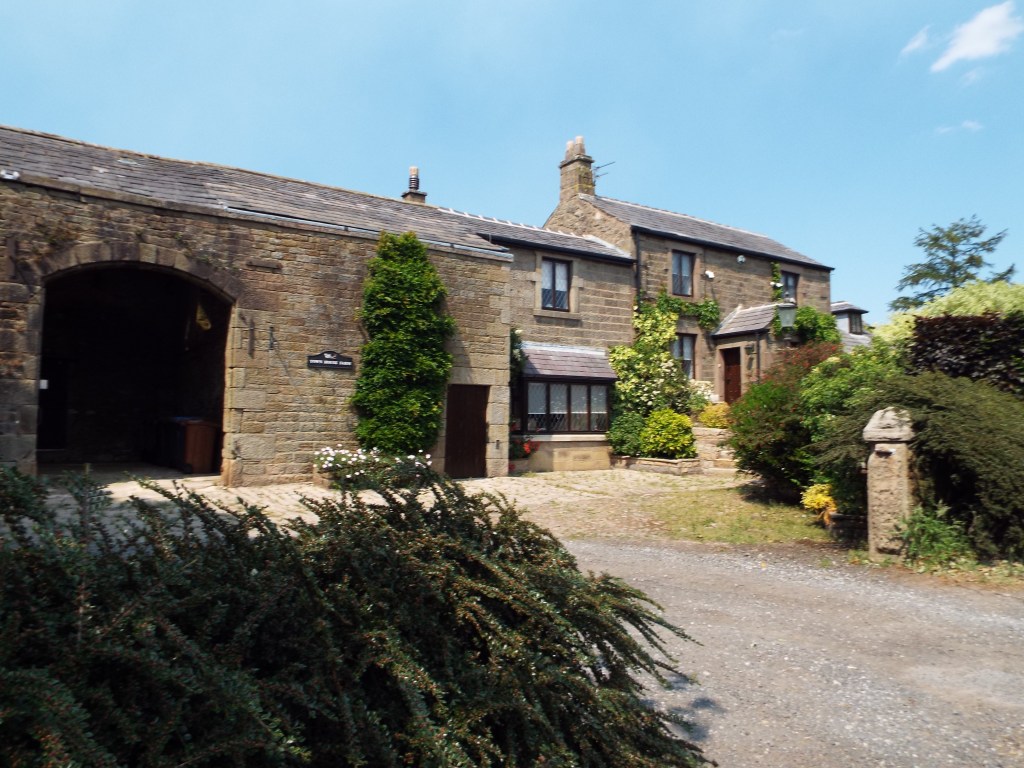
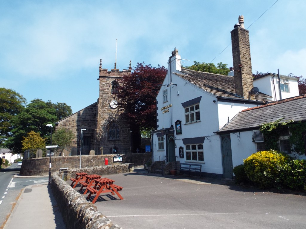
It’s the house that on my trip to Brindle a few weeks ago, I stopped to take a photograph of! It stands on what was once Balshaw land!
If I were into spookiness, I’d be wondering about it. What possessed me to stop and take a photo of this house, out of all the possible houses? Actually, I knew I’d seen its name somewhere, but I thought it was on the list of listed buildings in Brindle, which it isn’t.
It’s on the list of documents I found in Lancashire Archives, that I (infuriatingly) can’t get at at the moment. I can’t say for certain it’s the right man..
but…
In the 1680s John Balshaw lived there.

Leave a comment